
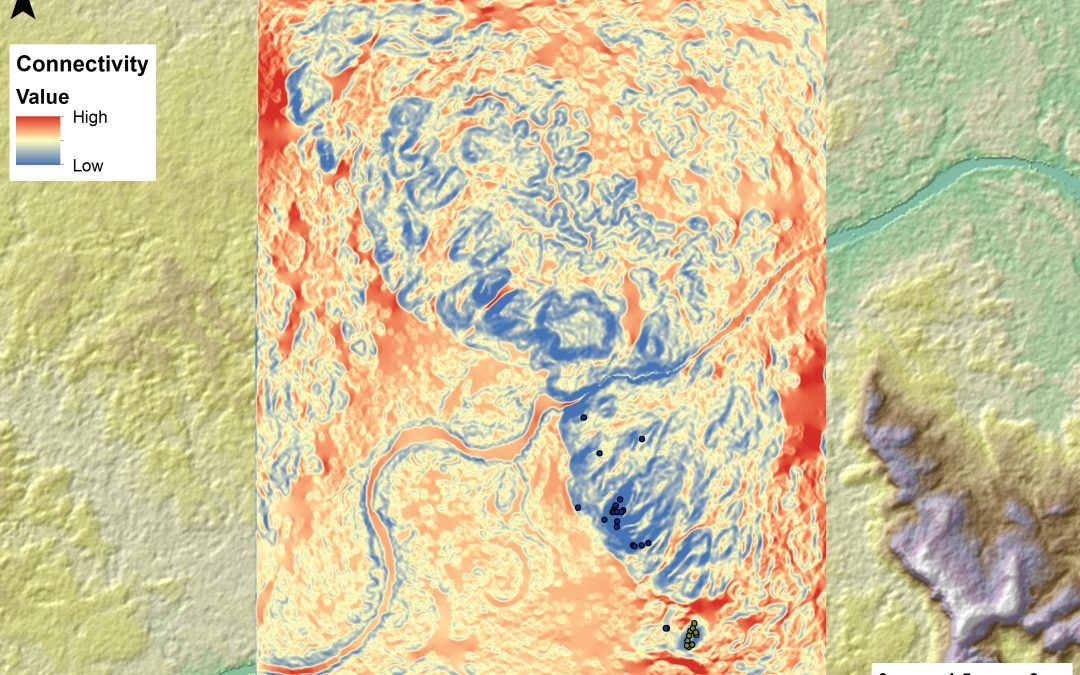
Understanding past movement patterns across a landscape is a complex task. Traditionally, this analysis has focused on identifying optimal travel routes through least-cost paths. However, we are more interested in the overall connectivity between all locations within the territory. To address this, we employed the Omniscape algorithm (McRae et al., 2016; Landau et al., 2021) in La Lindosa region. This recently developed approach was successfully applied for the first time in an archaeological case study by Parcero-Oubiña et al. (2024).
McRae, B. H., K. Popper, A. Jones, M. Schindel, S. Buttrick, K. R. Hall, R. S. Unnasch, and J. Platt. 2016. Conserving Nature’s Stage: Mapping Omnidirectional Connectivity for Resilient Terrestrial Landscapes in the Pacific Northwest. The Nature Conservancy, Portland, Oregon.
Landau, V.A., V.B. Shah, R. Anantharaman, and K.R. Hall. 2021. Omniscape.jl: Software to compute omnidirectional landscape connectivity. Journal of Open Source Software, 6(57), 2829. https://doi.org/10.21105/joss.02829
Parcero-Oubiña C, Fábrega-Álvarez P, Lynch J. 2024. On the Periphery of the Inka Empire: Spatial Arrangement at the Pre-Hispanic Rock-art Site of Villavil 2 (Catamarca, Argentina). Cambridge Archaeological Journal, 34(2):231-251. https://doi.org/10.1017/S0959774323000240